Good morning
On 21 October 1805, the Battle of Trafalgar was fought off Cape Trafalgar, a headland on Spain's Atlantic coast. The Royal Navy, led by Admiral Horatio Nelson, defeated a combined French and Spanish fleet. Nelson himself was killed in the fighting.
Today's issue stays with maps and borders. We visit Europe's highest capital city, an airport built below sea level, and a country whose coastline dwarfs the distance around the Earth.
In today's edition
- Europe's highest capital city is not Madrid
- An airport built on a drained lake bed
- Norway's coastline dwarfs the Earth's circumference
- North Macedonia's 26 years under a placeholder name
- Suriname beats Uruguay for smallest country
- Fill a grid with countries row by row
Andorra la Vella · Fact of the day
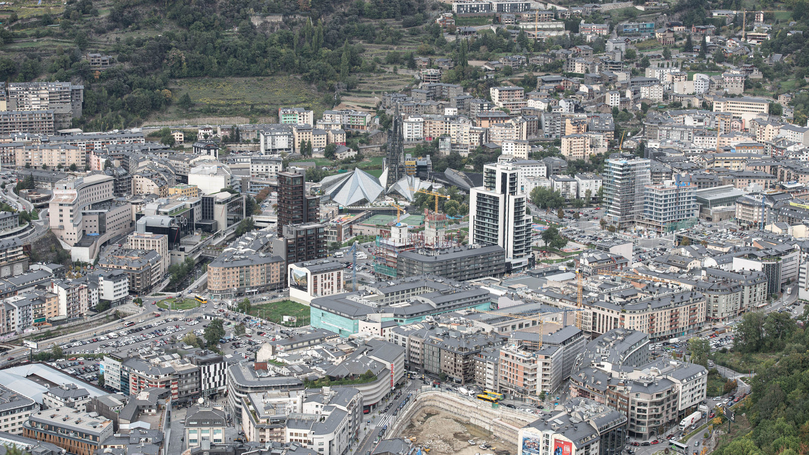
Andorra la Vella is Europe's highest capital city
Ask most people to name Europe's highest capital city and many will say Madrid, the capital of Spain, which sits 667 metres above sea level.
Madrid only holds that title inside the European Union. The true answer is Andorra la Vella, capital of Andorra, a small country tucked in the Pyrenees mountains between France and Spain. It stands 1,023 metres above sea level, almost as high as Dubai's Burj Khalifa, the world's tallest building at 828 metres, is tall.
The mix-up happens because Andorra is easy to overlook when ranking countries. It has no seat at the European Union table, so lists built from EU capitals alone leave it out, even though it stands higher than every one of them.
↗ Send this fact to a friend52.31° N, 4.77° E · Place of the day
Amsterdam's main airport sits below sea level
Amsterdam Airport Schiphol, the main airport of the Netherlands, is built on the bed of a lake. The Haarlemmermeer once covered this ground until three steam engines, built in Cornwall, England, pumped it dry by 1852.
Because of that history, Schiphol's runways sit 3.4 metres below sea level, lower than the surface of the sea just a short drive away. Dykes and pumps keep the water out, the same system that protects much of the Netherlands.
On 26 May 1573, a naval battle was fought on the open water that once covered this spot, between Dutch rebel ships and a Spanish-Amsterdam fleet. Today, passenger jets take off from the same ground.
 Play today's Worldle
↻ Also on the map
North Macedonia spent 26 years under a placeholder name In 1993, the United Nations admitted the country as "The former Yugoslav Republic of Macedonia". That was a placeholder name. Greece did not want it to use the name Macedonia on its own. In 2019, after a deal with Greece, the country became North Macedonia.
Suriname, not Uruguay, is the smallest country in South America Many people think Uruguay holds that title. It does not. Suriname is smaller. Suriname measures 163,820 sq km. Uruguay measures 176,215 sq km, a gap wide enough to fit a few extra countries the size of Luxembourg.
Between issues
Fancy a different kind of map challenge? GeoGrid gives you a 3x3 grid, each row and column set by its own clue. You fill every square with a country that fits both, until the whole grid works together.
 Play today's GeoGrid
Locate the country
Today's mystery shape · 21 October 2026

Here is today's mystery country, shown only by its outline. Take a guess based on its shape and size alone, no other clues given. We reveal the answer tomorrow.
Guess it on Worldle →Yesterday, revealed
Yesterday, 20 October 2026
It was Saint Lucia, Yesterday's mystery country was a tricky one for plenty of sharp guessers. If you landed on it straight away, well done. If not, its shape is worth another look next time you see a map.
60.47° N, 8.07° E · By the numbers
How Norway's coastline grows past Earth's own circumference
Measured as a simple line along the mainland, Norway's coast is 2,532 kilometres long. Norway also has 239,057 islands, islets and fjords. A 2024 official survey traced around every one of them and found the total reaches 102,936 kilometres, about 2.6 times the distance around the Earth at the equator. Only Canada's coastline is longer. The huge jump shows how a country's shape, and how closely you measure it, can change the numbers far more than its actual size does.
FREE · WEEKLY EMAIL · GEOGRAPHY
Put the world in your inbox.
A new geography brief on the site every day, and one in your inbox every week.
That's the world
See you tomorrow. The Teuteuf team
Sources: Wikipedia: Andorra la Vella · SkyVector: EHAM Amsterdam Schiphol Airport (aeronautical data derived from the Dutch AIP/LVNL) · United Nations, official member-states page: "Yugoslavia and Successor States" · CIA World Factbook (Suriname & Uruguay area) · Store norske leksikon (Norwegian national encyclopedia, owned by the Norwegian universities): "norskekysten", by Per Roger Lauritzen