Good morning
On 20 October 1944, American troops landed on Leyte, an island in the Philippines. It was the start of a campaign to take the country back from Japanese occupation. The commander, General Douglas MacArthur, waded ashore and kept a promise he had made two years before: "I have returned."
Today's issue looks at deserts, borders and distant points on the map, from Asia's largest desert to the westernmost tip of Africa.
In today's edition
- Why most people guess Asia's desert wrong
- Africa's westernmost point, further west than Europe
- Brunei's land, split in two by Malaysia
- A castle that predates Columbus's crossing
- Two countries, two borders from any sea
- Match countries across a tricky grid
Arabian Desert · Fact of the day
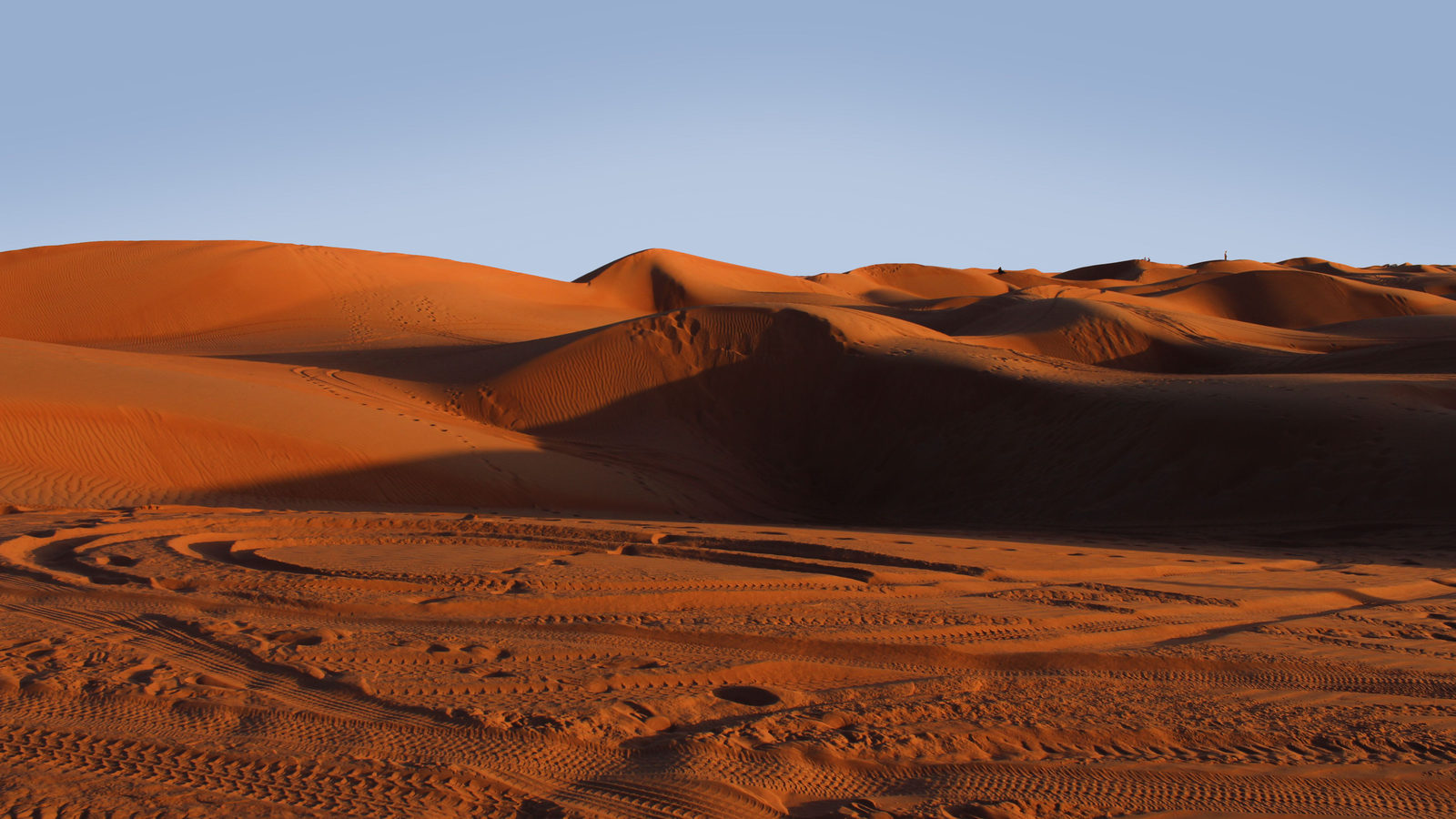
Asia's largest desert is the Arabian Desert, not the Gobi
Ask most people to name Asia's biggest desert and they will say the Gobi, the dry expanse that stretches across Mongolia and northern China. The Gobi is indeed huge, at about 1,295,000 square kilometres, and it is the largest desert in East Asia.
But Saudi Arabia, Yemen, Oman and their neighbours sit in Asia too, even though we often group them under the separate label "Middle East". Together their desert, the Arabian Desert, covers about 2,330,000 square kilometres, roughly 1.8 times the size of the Gobi. It even reaches past the famous sand sea of the Empty Quarter into gravel plains further north. Once it is counted, it beats the Gobi by a wide margin, and ranks second in the world only to the Sahara.
↗ Send this fact to a friend14.74° N, 17.53° W · Place of the day
Pointe des Almadies, Senegal
Pointe des Almadies is a headland on the Cap-Vert peninsula in Senegal, a country on the Atlantic coast of West Africa. It is part of Dakar, Senegal's capital, and it marks the westernmost point of mainland Africa.
Most people picture Africa as lying south of Europe, so they rarely check which continent reaches further west. Mainland Europe's westernmost point, Cabo da Roca in Portugal, sits about 700 kilometres further east than Pointe des Almadies. That means all of continental Europe, including the tip of Ireland, lies to the east of Dakar.
Stand on this headland and the nearest land in a straight line west is Brazil, across the open Atlantic.
 Play today's Worldle
↻ Also on the map
Ghana's Elmina Castle predates Columbus's Atlantic crossing Elmina Castle sits on the coast of Ghana, in West Africa. Portuguese builders began it in 1482, shipping cut stone from Lisbon. It was finished before any European sailed round Africa's southern tip, and before Columbus crossed the Atlantic.
Two countries sit two borders from the sea Most landlocked countries touch at least one coastal neighbour. Only Uzbekistan, in Central Asia, and Liechtenstein, in the Alps, do not. From either one, you must cross two other countries just to reach open water.
Between issues
Fancy a different kind of puzzle before tomorrow's issue? GeoGrid gives you a 3 by 3 grid and nine categories to match: countries with deserts, countries on a certain sea, countries with a certain flag colour. Fill every square and see how your knowledge of the map holds up.
 Play today's GeoGrid
Locate the country
Today's mystery shape could not be added to this issue. You can still play today's Worldle.
Yesterday, revealed
Yesterday's answer could not be added to this issue.
4.53° N, 114.73° E · By the numbers
Brunei's land and people, split in two
Brunei, a small country on the island of Borneo, is not one piece of land. Malaysia's Limbang district cuts straight through it, separating the eastern district of Temburong from the rest of the country. Temburong covers close to a quarter of Brunei's land, an area a little larger than Malta. Yet only about 2 in every 100 Bruneians live there. Until a bridge opened across Brunei Bay in 2020, reaching Temburong from the capital meant driving through four border checkpoints in Malaysia. It matters because a country's land and its people do not always spread out evenly.
FREE · WEEKLY EMAIL · GEOGRAPHY
Put the world in your inbox.
A new geography brief on the site every day, and one in your inbox every week.
That's the world
See you tomorrow. The Teuteuf team
Sources: WorldAtlas: 'The Deserts of Asia' (Oishimaya Sen Nag) · Wikipedia: Pointe des Almadies · UNESCO World Heritage Centre: 'Forts and Castles, Volta, Greater Accra, Central and Western Regions' (Ghana, ref. 34) · CIA World Factbook, 'Uzbekistan' (archived snapshot; the Factbook was retired in February 2026) · Encyclopaedia Britannica: Brunei (summary)