Good morning
On 9 October 1874, representatives from 22 countries met in Bern, Switzerland. They signed the treaty that created the General Postal Union, later renamed the Universal Postal Union. It turned separate national mail systems into one shared zone. A letter could then cross a border without new postage at every stop.
Today's issue looks at geography that bends the obvious map. A canal that runs the wrong way, an ocean point with no country, and Florida's real nearest neighbour.
In today's edition
- Why the Panama Canal runs the wrong way
- The ocean point that belongs to no country
- Florida's true nearest foreign neighbour
- Why Earth's clocks overflow a single day
- Fill a grid with countries that fit
- Guess a country from its outline
Panama Canal · Fact of the day
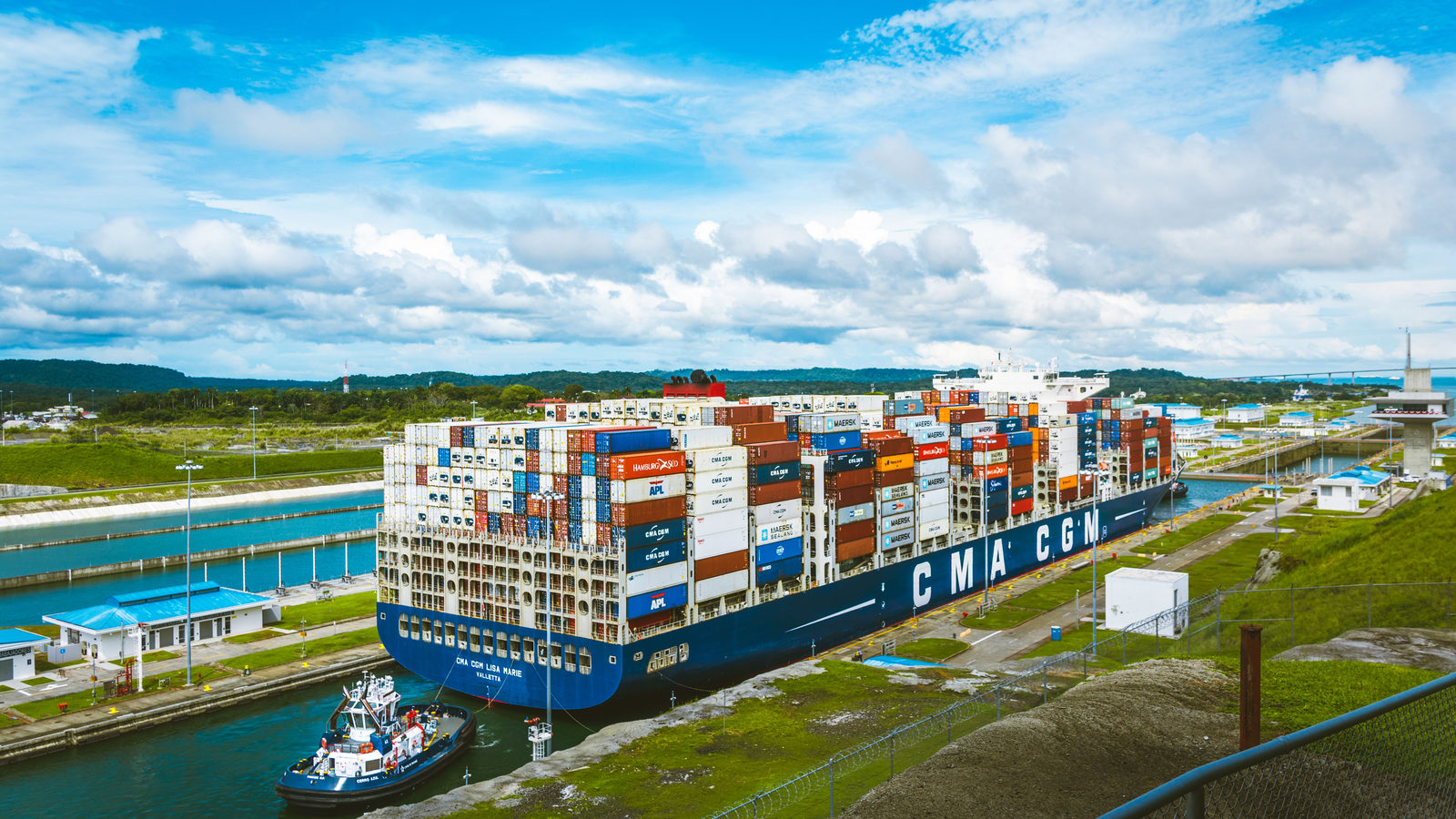
The Panama Canal's Pacific end lies east of its Atlantic end
Most people picture the Panama Canal running simply from east to west, linking the Atlantic Ocean on one side to the Pacific on the other. The real layout is stranger. Balboa, the canal's Pacific terminus, sits about 40 kilometres east of Colon, its Atlantic terminus, roughly the distance from London to Guildford. That is because the Isthmus of Panama does not run straight north to south. It bends back on itself, so the canal actually travels northwest to southeast rather than east to west. A ship leaving the Caribbean for the Pacific ends up slightly farther east, and further south, than where it started.
↗ Send this fact to a friend0.00° N, 0.00° E · Place of the day
Null Island, where the Equator meets the Prime Meridian
Null Island is the point where the Equator and the Prime Meridian cross, at zero degrees latitude and zero degrees longitude. It lies in the Gulf of Guinea, a stretch of the Atlantic Ocean off the coast of West Africa. The spot is open water about 4,940 metres deep, roughly 570 kilometres from the nearest land, a small island belonging to Ghana. No country owns it, since it sits entirely at sea. For 24 years a weather buoy was moored there to mark the exact point. The name comes from computing. When mapping software fails to read an address, it often defaults to zero, zero. Lost or broken data points from around the world end up piling at this one spot on the map.
 Play today's Worldle
↻ Also on the map
The Bahamas, not Cuba, is Florida's nearest foreign neighbour The Bimini Islands are part of the Bahamas. They sit about 80 kilometres east of Florida, closer than 50 nautical miles from Miami. Cuba lies nearly twice as far away, across a wider stretch of sea called the Straits of Florida.
Madagascar is the world's fourth-largest island Madagascar is a country of about 587,000 square kilometres. It sits in the Indian Ocean, roughly 400 kilometres off the coast of south-eastern Africa. A strip of sea called the Mozambique Channel separates it from the African mainland.
Between issues
Fancy a different kind of puzzle today? In GeoGrid, you fill a nine-square grid with countries that match a category for each row and each column at once. It rewards knowing the map in several directions.
 Play today's GeoGrid
Locate the country
Today's mystery shape · 9 October 2026
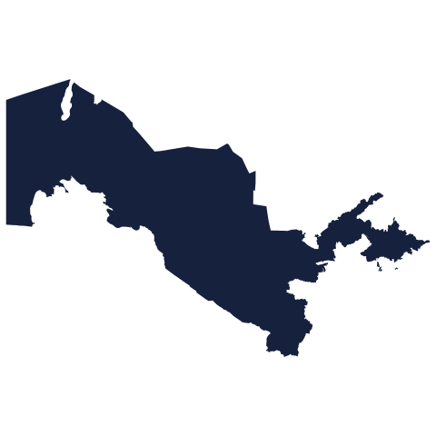
Today's silhouette is below. Take a guess at the country from its outline alone, then see how close you got. We reveal the answer tomorrow.
Guess it on Worldle →Yesterday, revealed
Yesterday, 8 October 2026
It was Jordan, Yesterday's silhouette was trickier than it looked for plenty of readers. If you guessed wrong, do not worry: some shapes give away far less than we expect. There is a fresh one to try today.
1.87° N, 157.40° W · By the numbers
Earth's clocks span more hours than a single day holds
Clocks around the world are not simply spread across one day. Baker Island, in the Pacific, keeps Coordinated Universal Time (UTC) minus 12, the earliest clock setting on Earth. Kiribati's Line Islands keep UTC plus 14, the latest. Between those two, the gap is 26 hours, two more than a single day actually contains. Because the gap is wider than a day, three different calendar dates are in use somewhere on Earth at once, for two hours out of every 24. This happens every morning, from ten o'clock to midday, UTC. It matters because the date line is not one simple boundary, but a bent and political one, drawn by countries rather than geometry.
FREE · WEEKLY EMAIL · GEOGRAPHY
Put the world in your inbox.
A new geography brief on the site every day, and one in your inbox every week.
That's the world
See you tomorrow. The Teuteuf team
Sources: Encyclopaedia Britannica: "Panama Canal" · NOAA National Data Buoy Center: Station 13010 (Soul) · Encyclopaedia Britannica: 'Bimini Islands' · UNESCO World Heritage Centre: Rainforests of the Atsinanana (Madagascar), Dossier 1257, Outstanding Universal Value · Wikipedia: International Date Line (§ Facts dependent on the IDL)