Good morning
On 8 October 1962, Algeria, a country in North Africa, joined the United Nations. It had won independence from France only months earlier, after a war that lasted nearly eight years and reshaped the country's borders and government.
Today's issue looks at rivers that break the rules, a waterfall taller than the one everyone names, and the lines that mark zero on the map.
In today's edition
- Africa's tallest waterfall is not the famous one
- A profile of the Taj Mahal's home city
- Why Africa alone sits on two zero lines
- Saudi Arabia's largest-country river gap
- The Congo River's double Equator crossing
- Guess the country from its outline
Tugela Falls · Fact of the day
Africa's tallest waterfall is not Victoria Falls
Most people asked to name Africa's tallest waterfall say Victoria Falls, on the border of Zambia and Zimbabwe. It is famous, and it does hold a world record, but not for height: it is the largest curtain of falling water on Earth, 1,708 metres wide. Measured from top to bottom, it drops at most 108 metres.
The true record for height belongs to Tugela Falls, in South Africa's Drakensberg mountains. It falls 948 metres in five separate leaps, about nine times the drop of Victoria Falls. The reason it stays so little known is simple: it carries far less water, and in dry months it can shrink to almost nothing.
↗ Send this fact to a friend27.18° N, 78.04° E · Place of the day
Agra, India
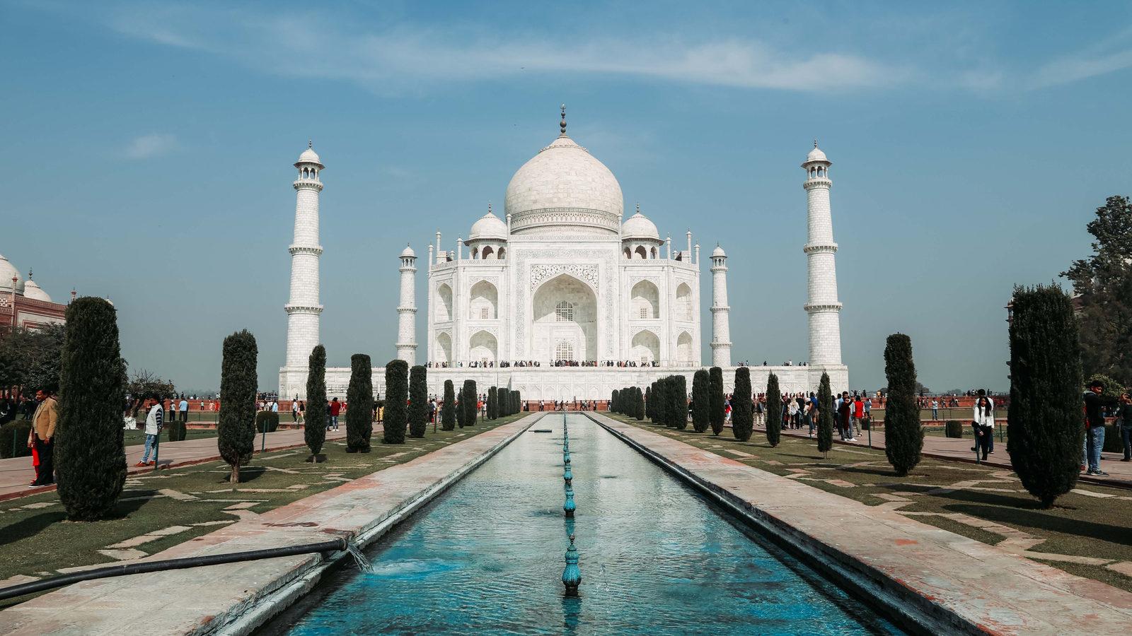
Agra is a city in the northern Indian state of Uttar Pradesh, on the right bank of the Yamuna River. It is home to the Taj Mahal, a white marble mausoleum that the Mughal emperor Shah Jahan built for his wife, Mumtaz Mahal, between 1631 and 1648.
What makes the site unusual is the scale of the grief behind it. An entire walled garden complex, 17 hectares in size, roughly the area of twenty football pitches, was built around a single tomb. UNESCO listed it as a World Heritage Site in 1983.
One detail sticks with most visitors. The building's colour shifts through the day, from soft pink at dawn to pale gold at sunset, as the marble catches the changing light.
 Play today's Worldle
↻ Also on the map
Saudi Arabia has no year-round river Saudi Arabia covers about 2.15 million square kilometres, in the Arabian Peninsula. It has no river that flows all year, only wadis, valleys that fill briefly after rain. That makes it the largest country on Earth without one.
The Congo River crosses the Equator twice The Congo River, in Central Africa, is the only major river whose course crosses the Equator twice. It bends north above the city of Kisangani, then curves back south near Mbandaka. That keeps rain falling somewhere in its basin all year.
Every Thursday · 30 questions
Thursday Thirty is live.
This set of the Thursday Thirty, for 8 October 2026, ranges across rivers, mountains, capitals and borders, with a few questions drawn from stories we have covered in recent issues. It is a relaxed way to test what has stuck, not a race against the clock. Pour your coffee, take your time with each question, and see how your geography holds up against readers around the world.
 Play this week's Thirty →
Last week, in numbers · October Thursday 1st · w38 · 1 October 2026
How 33,600 players scored · w38
Between issues
Fancy something different before tomorrow's issue? In GeoGrid, you fill a 3 by 3 grid with countries that match a mix of row and column clues, like sharing a border or starting with a certain letter. It rewards knowing your geography from a few different angles at once.
 Play today's GeoGrid →
Locate the country
Today's mystery shape · 8 October 2026
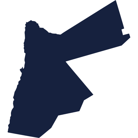
Today's mystery country is waiting below. Study its outline closely, think about which region it might sit in, and take your best guess before checking. We reveal the answer tomorrow.
Guess it on Worldle →Yesterday, revealed
Yesterday, 7 October 2026
It was Norway, Yesterday's country tripped up plenty of guessers, and that is half the fun of a good silhouette. If you landed on it quickly, well done. If not, take another look and see what gives it away next time.
0.00° N, 0.00° E · By the numbers
Where the Equator and Prime Meridian cross land
Africa is the only continent that both of the planet's zero lines cross on land. The Equator runs through the territory of 11 countries, and seven of them are in Africa. The Prime Meridian, the line that marks zero degrees longitude, crosses eight countries, and five of them are also in Africa. Picture two long rulers laid across the globe, one flat and one upright, meeting only over African soil. The two lines actually cross each other offshore, in the Gulf of Guinea. It matters because no other continent sits at this kind of geographic crossroads, which is why Africa anchors the whole system of latitude and longitude.
FREE · DAILY · GEOGRAPHY
Put the world in your inbox.
One surprising, entertaining geography brief each day. No spam; just a better sense of place.
That's the world
See you tomorrow. The Teuteuf team
Sources: Encyclopaedia Britannica: Tugela Falls · UNESCO World Heritage Centre: Taj Mahal (Dossier 252) · Wikipedia - List of countries and dependencies without rivers · EBSCO Research Starters: "Congo River" (Boslaugh, S.) · Royal Museums Greenwich: "What is the Prime Meridian, and why is it in Greenwich?"