Good morning
In 1977, Voyager 1 left Earth carrying a golden record etched with a map of pulsars rather than of any country, meant to tell whoever finds it how to find us.
Most maps exist for that same reason: to correct someone's wrong idea of where things actually are. Today's edition has a few closer to home: a swimsuit named after an atoll, a mountain far from the mainland and a continent outsized by a single country.
In today's edition
- A swimsuit named after a nuclear test site
- Australia's highest peak tops a smoking volcano
- Brazil outsizes an entire continent
- Three changes redrawing the map
- A grid game worth losing sleep over
- A coastline to place without a map
Bikini · Fact of the day
The swimsuit named after a nuclear test site
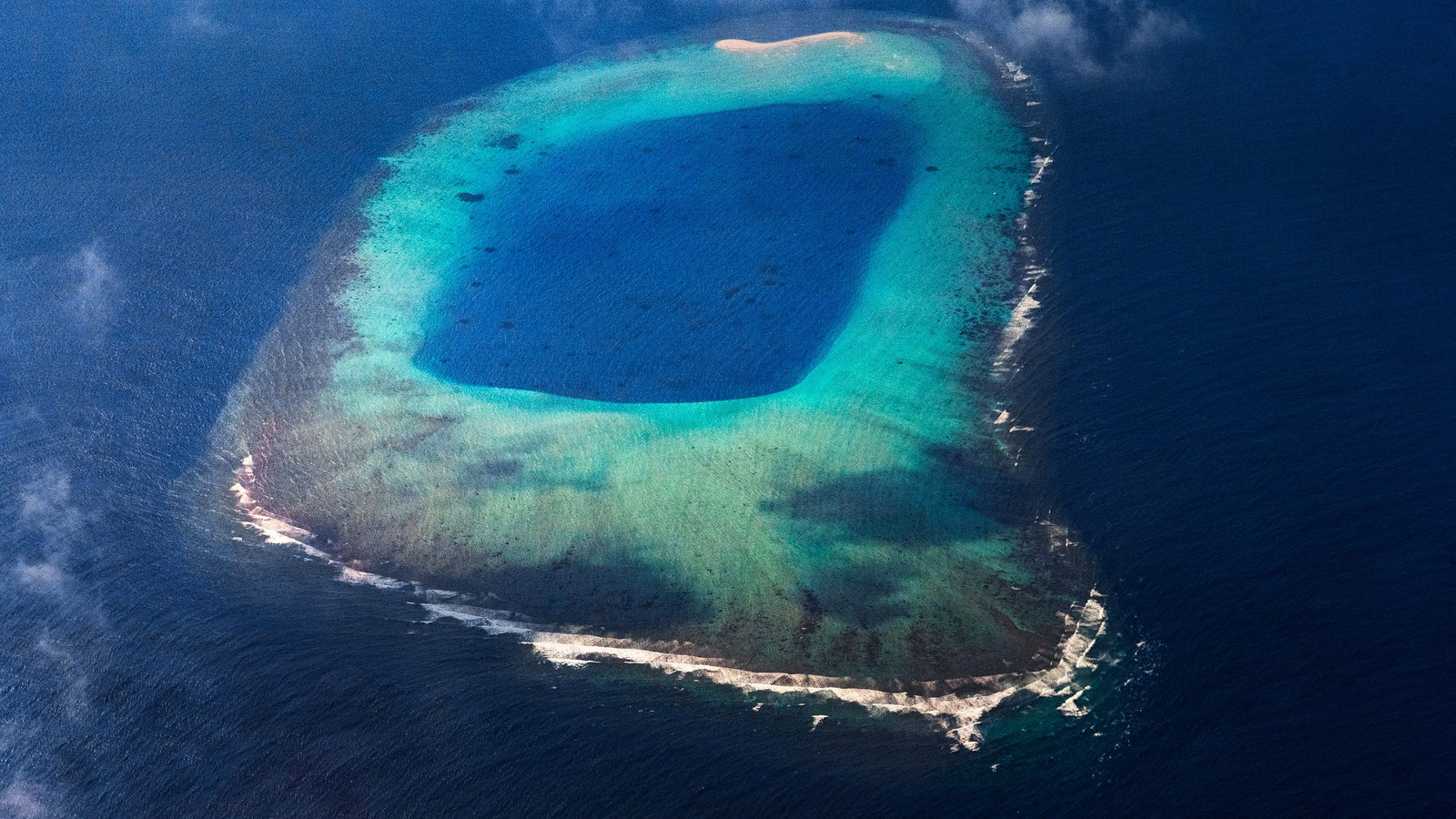
Say "bikini" and you picture a beach, not a bomb. But the word is a straight-up Pacific place name: Bikini Atoll, in the Marshall Islands, roughly 4,300 km southwest of Hawaii.
On 1 July 1946 the US detonated the 'Able' atomic bomb there as part of Operation Crossroads. Four days later, in Paris, designer Louis Réard unveiled his scandalously small two-piece and named it after the atoll. He was betting the design would land with the same explosive shock as the headlines that week. It worked: the swimsuit outlived the news cycle, and the atoll's name has been sewn into a global wardrobe word ever since.
↗ Send this fact to a friend53.11° S, 73.50° E · Place of the day
Mawson Peak, Heard Island
Four thousand kilometres from the Australian mainland, in the southern Indian Ocean roughly halfway to Antarctica, an ice-armored volcano called Big Ben smokes over an island almost nobody has ever set foot on. Its summit, Mawson Peak, rises 2,745 metres: 517 metres taller than Mount Kosciuszko, the peak every atlas prints as Australia's highest.
Heard Island has no airstrip, no town and no permanent residents, only glaciers, elephant seals, and an active vent. The country's true high point is a smoking sub-Antarctic cone, not a gentle alpine walk-up, and it has been climbed only a handful of times.
 Play today's Worldle
↻ The feed · what moved
Indonesia plans a capital beyond Java Nusantara, the planned capital under construction in Borneo rainforest since 2022 to replace sinking Jakarta, lays out government districts in its master plan. Every ministry that relocates there shifts Indonesia's political map away from Java for the first time in the country's history.
Everest's official height, revised A joint resurvey by Nepal and China revised the official elevation of the world's highest peak, a reminder that even the map's fixed points move as satellite geodesy gets sharper. Since then, the two governments have shared one agreed figure instead of competing numbers.
How the Maldives builds land against rising seas The Maldives has been reclaiming land off Malé, adding artificial islands and raising existing ones against sea-level rise, which expands the atoll nation's usable footprint even as its natural land shrinks elsewhere in the archipelago.
Between issues
One grid, and that particular quiet panic when your last guess is a country you're fairly sure is wrong. GeoGrid rewards the kind of geography knowledge you didn't know you had until the board forces it out of you.
 Play today's GeoGrid →
Locate the country
Today's mystery shape · 18 September 2026
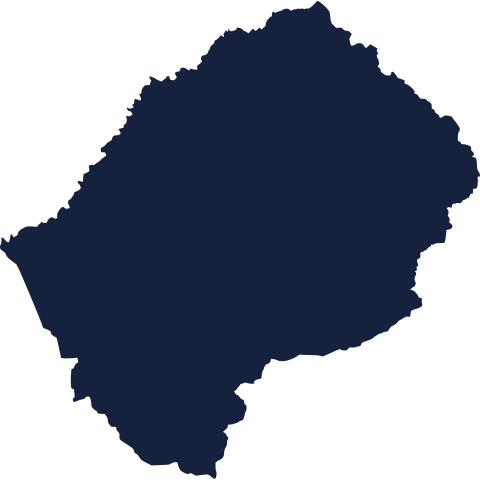
Somewhere on the map, one nation's outline is waiting to be named. Study the shape, trust your instincts, and see how close you can land. We reveal it tomorrow.
Guess it on Worldle →Yesterday, revealed
Yesterday, 17 September 2026
It was Uruguay, Yesterday's silhouette sent plenty of readers scrambling across continents before they finally landed on the right one. Some guesses were quick, others took the scenic route, but the reveal is in. See how your guess stacked up.
10.83° S, 53.02° W · By the numbers
A continent, out-continented
Line up the outlines with no latitude grid to cheat by, and the eye still expects the continent to win. It doesn't. Brazil's border alone encloses over 820,000 more square kilometres than the entire island continent of Australia. That's a single country, filed mentally as 'a big South American nation,' outsizing a landmass with its own tectonic plate and its own weather systems. Maps mislead by omission more than by distortion.
FREE · DAILY · GEOGRAPHY
Put the world in your inbox.
One surprising, entertaining geography brief each day. No spam; just a better sense of place.
That's the world
See you tomorrow. The Teuteuf team
Sources: Encyclopaedia Britannica: July 5: The Atomic Origins of the Bikini · Smithsonian Magazine: How the Summer of Atomic Bomb Testing Turned the Bikini Into a Phenomenon · History.com: Bikini introduced (July 5, 1946) · Wikipedia: Mawson Peak · PeakVisor: Mawson Peak