Good morning
On 3 November 1957, the Soviet Union launched Sputnik 2, a satellite carrying a dog named Laika into orbit around Earth. She was the first living creature to orbit the planet. Her flight showed scientists that a body could survive a rocket launch, data that later helped send humans into space.
Today's issue stays closer to the ground, with a look at some of the planet's more surprising high and low points.
In today's edition
- Why the Dead Sea beats Death Valley
- Mauritania's Eye of the Sahara is no crater
- A desert lake that was once the largest
- Vietnam's giant cave and Taiwan's many high peaks
- Spot the country from its outline
- Find the overlap between two country clues
Dead Sea · Fact of the day
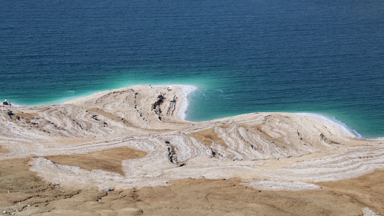
The lowest land on Earth is the Dead Sea shore, not Death Valley
Many people name Death Valley, in California, as the lowest point on Earth's land. Its Badwater Basin sits about 86 metres below sea level, which does make it the lowest point in North America.
The true record belongs to the shore of the Dead Sea, a salt lake between Jordan and Israel in West Asia. It lies roughly 430 metres below sea level, nearly five times deeper than Death Valley.
The Dead Sea has no river flowing out of it, so the water that enters can only leave by evaporating in the desert heat. As it evaporates, the lake's surface keeps sinking, by about a metre every year, so this already extreme low point gets slightly lower with each passing year.
↗ Send this fact to a friend21.13° N, 11.37° W · Place of the day
The Richat Structure, Mauritania
The Richat Structure is a huge set of circular rock rings in the Sahara desert in Mauritania, a country on Africa's north-west coast. It measures about 40 kilometres across, wide enough to be seen clearly from space, which is why it is nicknamed the Eye of the Sahara.
For decades many assumed it was a crater left by a meteorite. Rock surveys tell a different story. The rings formed when melted rock pushed up from deep underground about 100 million years ago, lifting the ground into a dome. Wind and rain then wore down the softer and harder layers at different rates, carving the rings seen today.
A rock sample once claimed as proof of a meteorite strike was studied more closely in 1969. It was found to be an ordinary mineral left by groundwater, not a scar from space.
 Play today's Worldle
↻ Also on the map
Sơn Đoòng holds the world's largest cave passage Hang Sơn Đoòng, in Vietnam's Phong Nha-Kẻ Bàng National Park, is one continuous passage over 5 kilometres long and up to 200 metres high. A local man found its entrance in 1990, but surveyors only measured it fully in 2009.
Taiwan has far more high peaks than Japan Taiwan, an island about a tenth the size of Japan, has over 260 summits above 3,000 metres, compared with roughly 21 in all of Japan. Its highest, Yushan, reaches 3,952 metres, taller than Japan's Mount Fuji.
Between issues
Fancy a change of pace before tomorrow's issue? GeoGrid gives you a 3 by 3 grid where each row and column asks for a country that fits two clues at once. Working out which country belongs in the overlap is the fun part.
 Play today's GeoGrid
Locate the country
Today's mystery shape could not be added to this issue. You can still play today's Worldle.
Yesterday, revealed
Yesterday's answer could not be added to this issue.
13.50° N, 14.50° E · By the numbers
How big Lake Chad once was, compared with today
About 7,000 years ago, a vast lake called Lake Mega-Chad covered part of what is now the Sahara desert, in Chad and its neighbouring countries. It spanned roughly 361,000 square kilometres, an area slightly larger than today's Caspian Sea, the world's biggest lake. Its only surviving remnant, Lake Chad, held an average of just 1,876 square kilometres of water between 2013 and 2016. That is about one two-hundredth of its ancient size. The shift shows how quickly a changing climate can turn a sea-sized lake into a small pool, within a span that is short by geological standards.
FREE · WEEKLY EMAIL · GEOGRAPHY
Put the world in your inbox.
A new geography brief on the site every day, and one in your inbox every week.
That's the world
See you tomorrow. The Teuteuf team
Sources: Geology.com: Below Sea Level · NASA Earth Observatory: "Eyeing the Richat Structure" (Image of the Day) · Live Science: 'Hang Son Doong: The world's biggest cave, so outrageous in size it fits 2 jungles and the Great Wall of Vietnam' (Sascha Pare) · Yushan National Park Headquarters, National Park Service, Ministry of the Interior (Taiwan): "Mt. Jade Main Peak" · NASA Earth Observatory: 'Remnants of an Ancient Lake' (Image of the Day, SRTM + Landsat 8; cites Drake & Bristow 2006 and Schuster et al. 2005)