Good morning
On 1 November 1755, a huge earthquake struck Lisbon, Portugal's capital, during morning mass on All Saints' Day. The quake, the fires and the tsunami that followed killed tens of thousands of people and flattened much of the city. It also prompted some of the first systematic studies of earthquakes, as officials surveyed survivors to find out what had happened.
Today's issue looks at Europe's oldest border, its most forested country and a capital that grows its own wine.
In today's edition
- What share of England is built on
- A parliament founded on a tectonic rift
- Europe's oldest and longest internal border
- A forested nation and a wine growing capital
- Guess the country from its outline
- Fit nine countries into one grid
England · Fact of the day
Under a tenth of England's land is built on
Most people picture England as a crowded island with little space left. When Ipsos asked people in 2023 how much of England is covered by homes, roads and other buildings, the average guess was 47%, nearly half the country.
The true figure, from official land-use data for April 2022, is 8.7%, under a tenth. That is roughly the area of Wales. The rest of England is fields, woods, water and open land.
The gap comes from where people spend their time. Homes, shops and offices sit inside that small 8.7%, so daily life gives a skewed picture. Farmland alone covers 63% of England, more than six times the built-up share.
↗ Send this fact to a friend64.03° N, 21.13° W · Place of the day
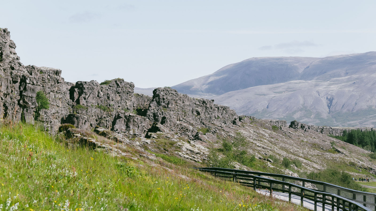
Þingvellir, Iceland
Þingvellir is a valley in southwest Iceland. It sits inside a wide rift, where two tectonic plates meet: the North American and the Eurasian. Around 930, Icelanders gathered there to found the Althing, their national parliament. It is recognised as the world's oldest surviving parliament.
The plates beneath Þingvellir are slowly pulling apart, at roughly 2 centimetres a year. That is about as fast as a fingernail grows. Since the assembly first met there, the valley floor has sunk by 3 to 4 metres. That is close to the height of a single-decker bus.
The Althing kept meeting at Þingvellir for almost 870 years, until 1798. It then moved to Reykjavík, Iceland's capital. UNESCO added the 9,270 hectare site to its World Heritage List in 2004. That area is roughly the size of Liechtenstein.
 Play today's Worldle
↻ Also on the map
Vienna grows wine inside the city Vienna, the capital of Austria, grows wine inside its own city limits. About 588 hectares of vineyards there are worked by around 280 producers. Since 2013, its local wine blend, called Wiener Gemischter Satz, has had protected status.
Finland is Europe's most forested country In 2022, forest covered 73.7% of Finland's land, more than any other country in Europe. That works out to roughly 4 hectares of forest for every person who lives there, an area about the size of four football pitches.
Between issues
Fancy a different kind of challenge? In GeoGrid, you fill a 3 by 3 grid with countries, where each one must fit both its row's category and its column's. It rewards knowledge you did not know you had.
 Play today's GeoGrid
Locate the country
Today's mystery shape · 1 November 2026
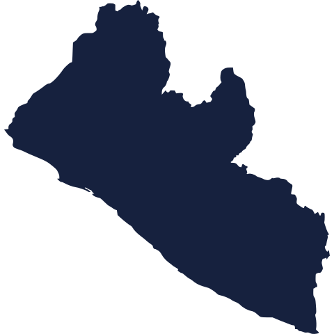
Today's silhouette is waiting below. Take a look at its outline and see if you can place it on the map before reading on. We reveal the answer tomorrow.
Guess it on Worldle →Yesterday, revealed
Yesterday, 31 October 2026
It was Italy, Yesterday's silhouette was a tricky one for many readers. If you placed it correctly, well done. If not, do not worry: these shapes can be deceptive, and there is a fresh one waiting for you below today.
40.50° N, 6.80° W · By the numbers
Length of the longest land border inside the EU
The border between Portugal and Spain runs 1,234 kilometres. That makes it the longest continuous land border between two European Union countries. The runner-up, between the Czech Republic and Germany, runs 815 kilometres. The gap between them is more than 400 kilometres, roughly the distance from London to Edinburgh. The Portugal-Spain border is also Europe's oldest. A treaty fixed its line in 1297, and the border has barely changed since. One short stretch, near the town of Olivenza, was never formally marked and remains officially undefined. A boundary drawn more than seven centuries ago still holding firm shows how rarely borders change in Western Europe.
FREE · WEEKLY EMAIL · GEOGRAPHY
Put the world in your inbox.
A new geography brief on the site every day, and one in your inbox every week.
That's the world
See you tomorrow. The Teuteuf team
Sources: GOV.UK: Department for Levelling Up, Housing & Communities, Official Statistics: "Land use statistics: England 2022" · UNESCO World Heritage Centre: "Þingvellir National Park" (Iceland), inscription 1152 · Wikipedia: "Austrian wine" (English), section "Vienna" · Eurostat: Statistics Explained, "Forests, forestry and logging" (European Forest Accounts, online data codes for_area_efa and reg_area3) · Wikipedia: Portugal–Spain border