Good morning
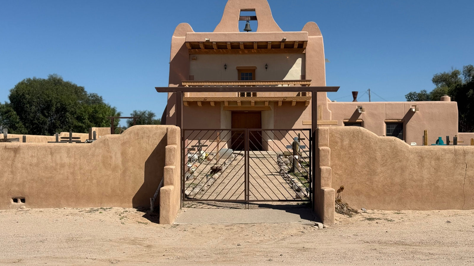
In 1610, Spanish settlers founded Santa Fe, high in the mountains of what is now New Mexico. It became the capital of a Spanish colonial province, and it still holds that role today, making it one of the oldest capital cities in North America.
Today's issue looks at height, old rock and long coastlines, from a mountain capital to a Newfoundland shore where Vikings once cut wood.
In today's edition
- Why most people get this state capital wrong
- A Viking site dated by growing tree rings
- How far does Canada's coastline really stretch
- What strait the Golden Gate Bridge actually crosses
- One ancient mountain range split by an ocean
- Find the shortest route between two countries
highest-state-capital · Fact of the day
Santa Fe, not Denver, is America's highest state capital
Ask people which American state capital sits highest above sea level, and most will say Denver, Colorado. Its nickname, the Mile High City, refers to an elevation of 5,280 feet, or 1,609 metres, learned by generations of schoolchildren.
Denver is only the third-highest state capital. Santa Fe, New Mexico, actually tops the list. It sits in the Sangre de Cristo Mountains at roughly 7,000 feet, or 2,130 metres, almost as tall as the Empire State Building. Cheyenne, Wyoming, comes second, on a high plateau at 6,062 feet, or 1,847 metres.
Denver's fame rests on its nickname, not on real height. It lies in a river valley at the foot of the Rocky Mountains, while Santa Fe and Cheyenne sit on genuinely high ground.
↗ Send this fact to a friend51.60° N, 56.80° W · Place of the day
L'Anse aux Meadows, Newfoundland
L'Anse aux Meadows is a small site on the northern tip of Newfoundland, a Canadian island off the Atlantic coast of North America. It is the only confirmed Viking settlement anywhere in the Americas.
Scientists dated the site using tree rings. A burst of cosmic rays in AD 993 left a clear spike inside growing wood that year. Counting rings outward from that spike to the bark on Norse-cut timbers gave an exact year: AD 1021.
That makes 1021 the earliest scientifically proven year of European presence in the Americas, 471 years before Christopher Columbus reached the Caribbean in 1492.
 Play today's Worldle
↻ Also on the map
San Francisco's famous bridge is named after a strait In 1937, the Golden Gate Bridge opened at the entrance to San Francisco Bay in California. The gap it spans is called the Golden Gate strait. Its two towers stand 227 metres tall, with a 1,280 metre span between them.
Scotland's mountains and the Appalachians were once one range The Scottish Highlands and Norway's mountains are the worn remains of one range. It formed about 400 million years ago, when an ancient ocean closed. The Atlantic Ocean began opening around 200 million years ago. That split off the range's other half, now called the Appalachian Mountains.
Between issues
GeoGrid gives you a 3 by 3 grid and nine clues. Each row and each column names a category, and you fill in a country that fits both. It rewards knowing odd details about the world, well beyond capital cities.
 Play today's GeoGrid
Locate the country
Today's mystery shape · 16 October 2026
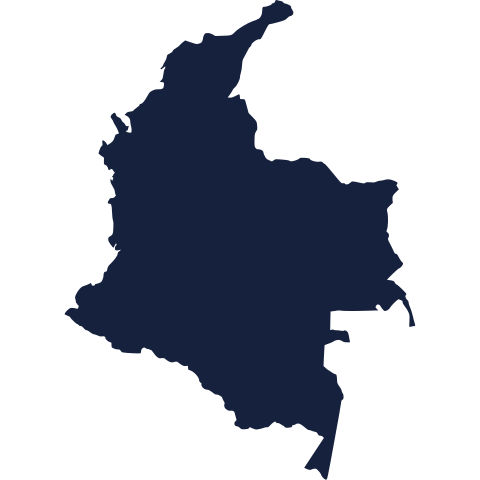
Today's silhouette is waiting for your best guess. Study its coastline and borders, then see if you can name the country. We reveal the answer tomorrow.
Guess it on Worldle →Yesterday, revealed
Yesterday, 15 October 2026
It was Myanmar, Yesterday's silhouette was a tricky one for many readers. Whether you spotted it straight away or needed every clue on offer, well played either way. There is a fresh one waiting for you today.
62.40° N, 96.00° W · By the numbers
The length of the world's longest national coastline
Canada's coastline measures 243,042 kilometres, counting every bay, inlet and island shore. Indonesia, a nation of thousands of islands in Southeast Asia, has the next longest at 54,716 kilometres. Canada's total is so large it could wrap around the Earth at the equator six times over. It is longer than every other country's coastline added together. The huge figure comes from Canada's many islands and its deeply cut northern coast, not from one long open shore. That matters because so much of Canadian life, from Atlantic fishing ports to Arctic shipping routes, depends on this edge of water.
FREE · WEEKLY EMAIL · GEOGRAPHY
Put the world in your inbox.
A new geography brief on the site every day, and one in your inbox every week.
That's the world
See you tomorrow. The Teuteuf team
Sources: U.S. National Park Service: 'Santa Fe New Mexico' (nps.gov place page) · Kuitems, M., Wallace, B.L., Lindsay, C. et al., "Evidence for European presence in the Americas in ad 1021", Nature 601, 388-391 (peer-reviewed, open access) · Golden Gate Bridge, Highway & Transportation District (official): Design & Construction Stats · Encyclopaedia Britannica, "Appalachian orogenic belt" · Statistics Canada: Canada Year Book 2012, 'International perspective'