Good morning
On 5 October 1910, Portugal became a republic. A revolution in Lisbon forced King Manuel II into exile, ending centuries of monarchy and creating the First Portuguese Republic.
Today's issue looks at places that are not quite what they seem. We cover ancient seabed at the summit of Mount Everest, an island split between three countries, and how Singapore has grown its land since 1960.
In today's edition
- Ancient seabed sits atop Mount Everest
- Borneo, the island split between three countries
- How Singapore grew its land since 1960
- A stone city that gave Zimbabwe its name
- Find a country that fits two clues
- Guess tomorrow's silhouette before anyone else
Everest's summit rock · Fact of the day
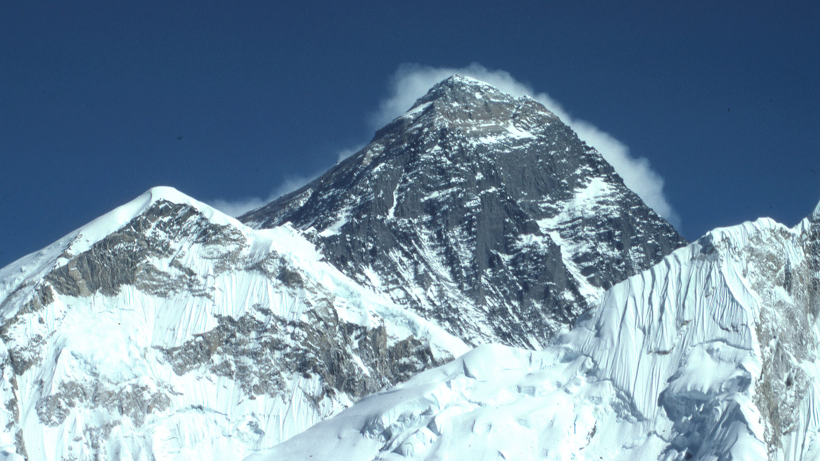
The top of Mount Everest is made of ancient seabed
Most people picture the summit of Mount Everest, on the border of Nepal and China, as solid granite worn smooth by wind. The rock at the very top is actually marine limestone, known as the Qomolangma Formation.
It formed around 450 to 470 million years ago, on a warm, shallow sea floor. It still holds fossils of ancient sea creatures, including trilobites and crinoids, small animals that once lived in that ocean.
That seabed sat on the edge of India long before the mountain existed. India then collided with Asia. The collision pushed the rock upward by nearly 9 kilometres, roughly the height of Everest itself, carrying an old ocean floor to the highest point on Earth's surface.
↗ Send this fact to a friend0.50° N, 114.00° E · Place of the day
Borneo
Borneo is an island in Southeast Asia, lying between the South China Sea and the Java Sea. At around 745,000 square kilometres, it is the world's third-largest island, smaller only than Greenland and New Guinea.
It is also the only island on Earth divided among three separate countries. Indonesia governs about three-quarters of it, as the five provinces of Kalimantan. Malaysia holds roughly a quarter, as the states of Sabah and Sarawak. The rest, a strip on the northwest coast, belongs to Brunei, a small country whose entire territory lies on this one island.
A traveller could walk from Indonesian soil into Malaysian soil, and from there into Brunei, without ever boarding a boat or a plane.
 Play today's Worldle
↻ Also on the map
The stone city that named a country Great Zimbabwe is a stone city built by the Shona people between about 1100 and 1450 AD. It stands near the present-day city of Masvingo, in the country of Zimbabwe. The country took its name from this city when it became independent on 18 April 1980. Zimbabwe means "houses of stone".
Two look-alike peninsulas, one quiet and one active A peninsula is land with water on most sides. Russia's Kamchatka Peninsula and Mexico's Baja California Peninsula are both close to 1,250 kilometres long. Kamchatka has about 160 volcanoes, and 29 are still active. Baja California's last eruption was around 1746.
Between issues
In GeoGrid, you fill a 3 by 3 grid. Every row and column sets its own test, such as a country on a certain continent or one whose name starts with a certain letter. Each square needs a country that fits two clues at once.
 Play today's GeoGrid
Locate the country
Today's mystery shape · 5 October 2026
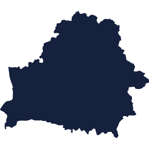
Today's Worldle shows a country as a silhouette, revealed piece by piece with every guess. Study the shape, take your best guess, and we reveal the answer tomorrow.
Guess it on Worldle →Yesterday, revealed
Yesterday, 4 October 2026
It was Japan, If yesterday's shape had you stumped, you were not alone. Coastlines and borders rarely look the way we imagine from memory. Take another look tomorrow, with a fresh country and a clean slate.
1.35° N, 103.82° E · By the numbers
How much land Singapore has added since 1960
Singapore, a city-state off the southern tip of Malaysia, has grown from 581.5 square kilometres in 1960 to 744.3 square kilometres by December 2025. That is an increase of about 163 square kilometres, nearly 28% more land than it started with. Almost all of it came from reclaiming land from the sea, using sand and earth to extend the coastline. The land gained since 1960 is, by itself, larger than the whole of Liechtenstein. For a small, crowded country with no room to expand on land borders, the sea has been the only direction left to grow.
FREE · DAILY · GEOGRAPHY
Put the world in your inbox.
One surprising, entertaining geography brief each day. No spam; just a better sense of place.
That's the world
See you tomorrow. The Teuteuf team
Sources: Wikipedia: 'Geology of Mount Everest' · WorldAtlas: "Borneo" (Jason Shvili) · UNESCO World Heritage Centre: Great Zimbabwe National Monument (Zimbabwe) · Wikipedia: Kamchatka Peninsula · SingStat Table Builder (Singapore Department of Statistics), table M890151 'Land Area (As At December), Annual': data source: Singapore Land Authority