Good morning
On 2 October 1869, Mohandas Gandhi was born in Porbandar, a coastal town in the western Indian state of Gujarat. He went on to lead India's campaign for independence from British rule, using non-violent protest as his main method. Porbandar was then a small princely state; today it is a fishing port on the Arabian Sea.
This issue looks at how coastlines can mislead the eye, an island state with no land border, and the ocean that covers almost a third of the planet.
In today's edition
- Why Santiago sits east of New York City
- Tasmania, Australia's only island state
- The Pacific Ocean's true size in numbers
- A channel joining two South American rivers
- The Nile's route to the Mediterranean Sea
- Match countries to a three by three grid
Santiago · Fact of the day
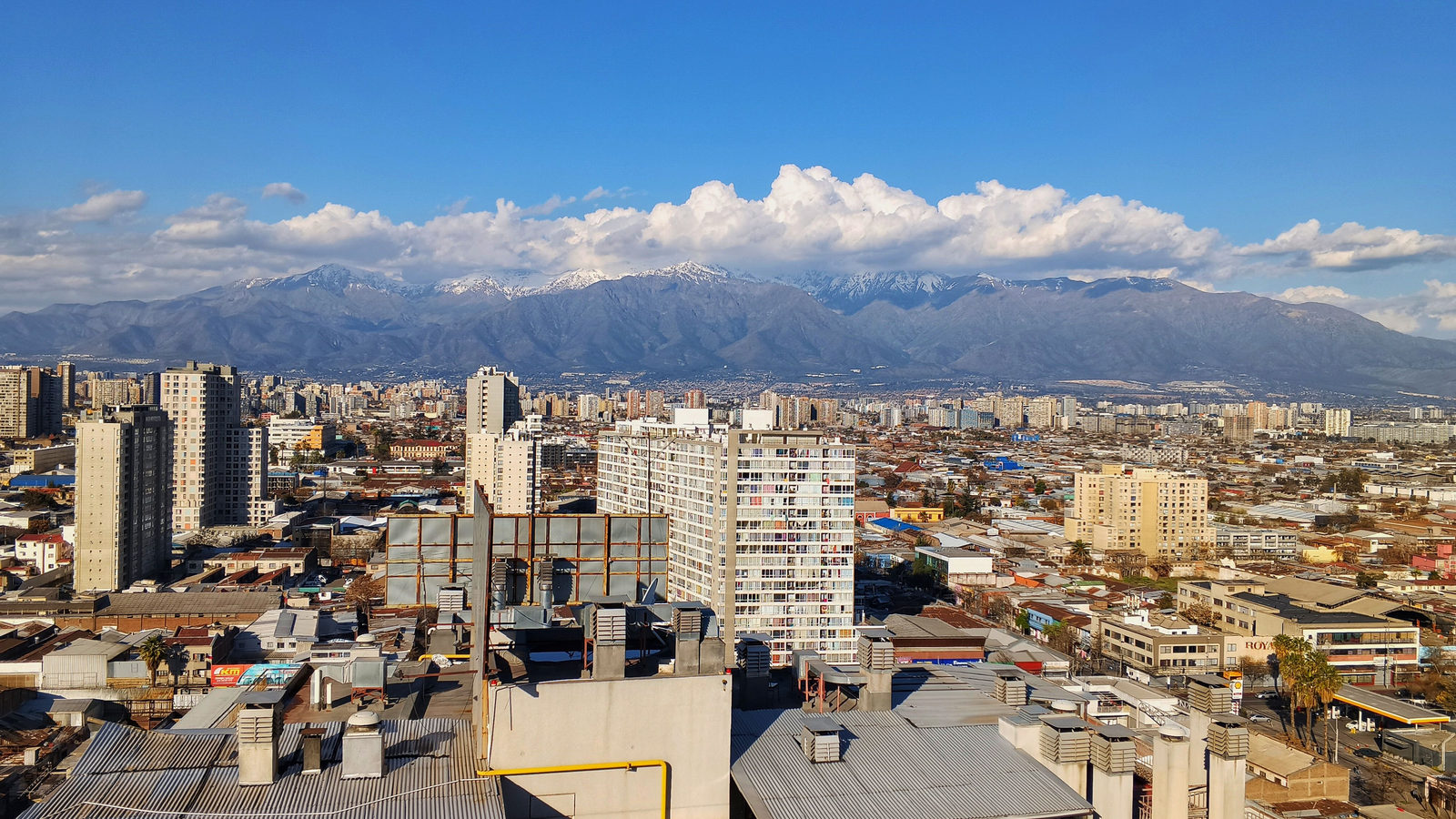
Santiago, Chile is east of New York City
Most people picture South America sitting directly under North America, so its Pacific coast should line up with the west coast of the United States. It does not. Santiago, the capital of Chile, sits on longitude 70.6 degrees west. New York City sits on 74.0 degrees west. That puts Santiago about 3.3 degrees of longitude further east than New York, roughly the distance from New York to Cleveland.
The reason is that South America is not stacked neatly beneath North America. The whole continent is shifted markedly to the east. So a city on South America's Pacific shore can still lie east of a city on North America's Atlantic shore. Which ocean a coast faces says nothing about how far east or west it actually is.
↗ Send this fact to a friend42.10° S, 147.20° E · Place of the day
Tasmania
Tasmania is an island state of Australia, lying off the country's south-east corner. It is separated from the mainland by Bass Strait, a stretch of water that averages about 240 kilometres wide, roughly the distance from London to Amsterdam.
It is the only Australian state or territory with no land border at all, since every neighbour it has is reached by sea. It is also the smallest state by area, covering 68,401 square kilometres, less than one percent of Australia's total land area. A traveller heading south from the Tasmanian coast crosses open ocean all the way to Antarctica, with no other landmass in between.
 Play today's Worldle
↻ Also on the map
A natural channel links two great rivers The Casiquiare is a river channel in southern Venezuela. It is about 350 kilometres long. It carries water from the Orinoco River south into the Rio Negro, which flows on into the Amazon. No other place on Earth has a permanent natural channel joining two major rivers like this.
The Nile flows into the Mediterranean Sea The Nile runs about 6,650 kilometres north through Egypt. Below Cairo it splits into two branches, the Rosetta and the Damietta. Together they form the Nile Delta, where the river finally meets the Mediterranean Sea.
Between issues
Fancy a different kind of challenge before the next issue lands? GeoGrid gives you a three by three grid, each row and column set by its own category. Fill every square with a country that fits both, drawing on what you know of maps, capitals and borders.
 Play today's GeoGrid
Locate the country
Today's mystery shape · 2 October 2026
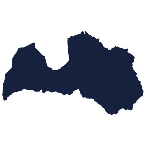
Today's silhouette is waiting below. Study its outline and borders, then take your best guess before you scroll on. We reveal it tomorrow.
Guess it on Worldle →Yesterday, revealed
Yesterday, 1 October 2026
It was Timor-Leste, Yesterday's outline was trickier than it looked, and plenty of guesses landed on a neighbouring country first. If you got there, well spotted. If not, borders can be deceiving from above, and there is a fresh silhouette to try today.
0.00° N, 160.00° W · By the numbers
The size of the world's oceans
The Pacific Ocean covers about 165 million square kilometres. That is roughly 32 percent of the entire surface of the planet, counting land and sea together. The Atlantic Ocean, the next largest, covers about 106 million square kilometres. The Pacific is therefore roughly twice the size of the Atlantic. It is so large that all the world's continents could fit inside it with room to spare. Its size is one reason ships and aircraft crossing it plan for journeys measured in days, not hours.
FREE · DAILY · GEOGRAPHY
Put the world in your inbox.
One surprising, entertaining geography brief each day. No spam; just a better sense of place.
That's the world
See you tomorrow. The Teuteuf team
Sources: Wikipedia: Santiago · Geoscience Australia: 'Border Lengths - States and Territories' and 'Area of Australia - States and Territories' · Wikipedia, 'Casiquiare canal' (current revision) · National Geographic Education: "Nile River" · NOAA National Ocean Service: "What is the largest ocean basin on Earth?"