Good morning
On 1 October 1968, Equatorial Guinea became independent from Spain. It remains the only country in mainland Africa where Spanish is an official language, a legacy of nearly two centuries of Spanish rule.
Today's issue looks at a desert bigger than its famous neighbour, a capital city almost on the Equator, and how one small island nation keeps its taps running.
In today's edition
- South America's true largest desert
- Quito, the capital nearest the Equator
- How Malta turns seawater into tap water
- Easter Island's owner and Ukraine's true size
- Guess the country from its outline
- Fill a grid of countries by category
Patagonian Desert · Fact of the day
South America's biggest desert is not the Atacama
Ask people to name South America's desert and most say the Atacama, the strip in Chile famous as the driest place on Earth outside the poles. But the Atacama covers only about 105,000 square kilometres, a thin ribbon squeezed between the Andes mountains and the Pacific Ocean.
The continent's largest desert is the Patagonian Desert, spread across southern Argentina. At about 673,000 square kilometres, it is more than six times the size of the Atacama, roughly the combined area of France and Germany.
The Atacama is famous because it barely rains there at all. The Patagonian Desert gets little rain too, for a simpler reason: the Andes block moisture blowing in from the Pacific, leaving a vast, windswept plain behind them.
↗ Send this fact to a friend0.22° S, 78.51° W · Place of the day
Quito
Quito is the capital of Ecuador, a country on South America's Pacific coast. It sits high in the Andes mountains, at 2,850 metres above sea level, making it the highest official capital city in the world.
Quito is also the national capital closest to the Equator, the imaginary line around the middle of the Earth. Its centre lies only about 24 kilometres south of the line, closer than any other capital, including Kampala in Uganda.
The Equator itself crosses the northern edge of the city, at a site called San Antonio de Pichincha. A monument called the Mitad del Mundo, meaning 'middle of the world', marks the spot where visitors can stand with one foot in each hemisphere.
 Play today's Worldle
↻ Also on the map
Easter Island belongs to Chile Easter Island is a Polynesian island in the South Pacific. It is famous for its giant stone statues. In 1888, it became part of Chile, even though it lies about 3,700 kilometres from the Chilean coast.
Ukraine is the largest country entirely within Europe Ukraine covers about 603,600 square kilometres. That makes it the largest country that lies entirely within Europe. Russia is bigger still, but it spans both Europe and Asia, so it is not counted as purely European.
Every Thursday · 30 questions
Thursday Thirty is live.
It's Thursday, 1 October 2026, so the Thursday Thirty is ready. This set of thirty questions ranges across capitals, borders, rivers and mountains, mixing familiar landmarks with a few that will test even seasoned geography readers. There is no clock and no pressure, so take your time working through the set, then come back to see how the results compare with everyone else who played.
 Play this week's Thirty →
Last week, in numbers · September Thursday 24th · w37 · 24 September 2026
How 33,436 players scored · w37
Between issues
Fancy a puzzle with your coffee? GeoGrid gives you a 3x3 grid where each row and column sets a rule, and you fill every square with a country that fits both. It rewards a wide knowledge of the map, and there is a fresh grid each day.
 Play today's GeoGrid
Locate the country
Today's mystery shape · 1 October 2026
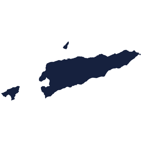
Today's silhouette is waiting for your best guess. Study its outline, think about its coastline and shape, and see if you can place it on the map. We reveal it tomorrow.
Guess it on Worldle →Yesterday, revealed
Yesterday, 30 September 2026
It was Jamaica, Yesterday's country is revealed above. If you placed it straight away, well done. If not, no matter: every outline gets easier to read the more you play, so take a moment to fix its shape in your mind before tomorrow's round.
35.88° N, 14.58° E · By the numbers
Where Malta's tap water comes from
Malta has no rivers and no natural lakes, so it cannot rely on rain the way most countries do. In 2024, the island supplied 38.8 million cubic metres of drinking water in total. Two thirds of that, 25.7 million cubic metres, came from the sea. Four plants remove the salt from seawater, a process called desalination. Only a third came from underground water. That makes Malta the most water-scarce country in the European Union. Without the sea, its taps would run dry.
FREE · DAILY · GEOGRAPHY
Put the world in your inbox.
One surprising, entertaining geography brief each day. No spam; just a better sense of place.
That's the world
See you tomorrow. The Teuteuf team
Sources: WorldAtlas: 'The Major Deserts Of South America' · UNESCO World Heritage Centre: City of Quito (Ecuador), inscribed 1978 · UNESCO World Heritage Centre: Rapa Nui National Park (property no. 715) · Wikipedia: List of European countries by area · Eurostat, Statistics Explained: 'Water statistics'