Good morning
In 1783, three men in Paris signed away an empire. The Treaty of Paris ended the American Revolutionary War and, with a few strokes of a pen, redrew the map of North America.
The negotiators argued for weeks over rivers no one had properly surveyed. Those lines still hold today. This morning we're staying with maps that shift: a flag missing one of its nations, a tiny island's lost fortune and Europe's real low point.
In today's edition
- The flag missing one of its four nations
- A tiny Pacific island's forgotten fortune
- Europe's actual low point isn't the Netherlands
- Three moves across the world map
- Guess today's mystery country before the reveal
- A flag that gives itself away slowly
Union Jack · Fact of the day
The flag with no symbol for Wales
Most people assume Britain's flag speaks for all four nations of the United Kingdom. It doesn't. The Union Jack layers the crosses of three patron saints (England's St George, Scotland's St Andrew and Ireland's St Patrick), but Wales appears nowhere on it: no cross, no stripe, no colour of its own.
The gap dates to 1606, when the flag was first stitched together. Wales had already been annexed into the Kingdom of England for the best part of a century, ruled as a principality rather than a kingdom in its own right, so it was simply folded into England's red cross instead of being granted a symbol to call its own. The omission has lasted more than 400 years.
↗ Send this fact to a friend0.53° S, 166.93° E · Place of the day
Nauru
Nauru is barely there: a single raised coral island in the central Pacific, 21 square kilometres of scrub and old mining scars, home to fewer than 8,000 people and no capital city to speak of.
By 1975 it was, briefly, one of the richest places on Earth, second only to Saudi Arabia in income per person, at roughly US$50,000 a head. The wealth came from phosphate: millennia of seabird droppings, compressed into rock and shipped out by the tonne until the interior was strip-mined into a moonscape.
Today the money is gone, the birds are mostly gone, and the island's shape on a map is one of the smallest silhouettes you will ever have to name.
 Play today's Worldle
↻ The feed · what moved
A calving front redraws the coast A satellite resurvey of the Getz Ice Shelf shows its calving front has retreated more than a kilometre since the last official chart, pushing Antarctica's mapped coastline further south. It means updating the continent's outline for the next print run.
Reclaimed ground, redrawn shoreline Land reclamation off Funafuti has added several hectares of new ground to Tuvalu's main atoll, the first expansion of its coastline in decades. It's a rare case of a country's outline growing rather than shrinking on the map.
A road cuts through the map Construction crews pushed a highway corridor deep into previously roadless rainforest in the eastern DRC. Earlier satellite images showed the area as unbroken green; later images show a route cutting through it, the region's first through-road on the map.
Between issues
GeoGrid is that particular flavour of stuck where you know exactly which country you need and can't quite place it. Then the grid clicks and everything you half-remembered suddenly fits.
 Play today's GeoGrid →
Locate the country
Today's mystery shape · 16 September 2026
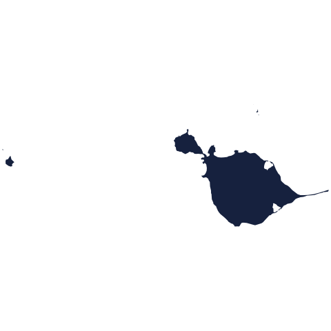
Today's mystery shape is waiting: make your guess, and we'll reveal it tomorrow.
Guess it on Worldle →Yesterday, revealed
Yesterday, 15 September 2026
It was South Sudan, the answer to yesterday's mystery shape.
43.65° N, 51.75° E · By the numbers
Europe's deepest shore
Ask someone where Europe dips below sea level and most will say the Netherlands, with all those tidy polders reclaimed from the water. But the continent's actual low point sits on the Russian shore of the Caspian Sea, about 28 metres below sea level, roughly four times deeper than the Zuidplaspolder's 6.76 metres. There's no dyke or windmill to mark it, only the flat hush of an inland sea with nowhere to drain to, lower than the country everyone assumes holds the record.
FREE · DAILY · GEOGRAPHY
Put the world in your inbox.
One surprising, entertaining geography brief each day. No spam; just a better sense of place.
That's the world
See you tomorrow. The Teuteuf team
Sources: The Royal Family: official 'Union Jack' page (royal.uk) · Historic UK: The Vexillology of Wales and the Union Flag · Wikipedia: Union Jack · Wikipedia: Economy of Nauru · Encyclopædia Britannica: Nauru